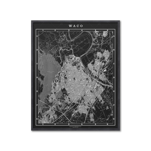
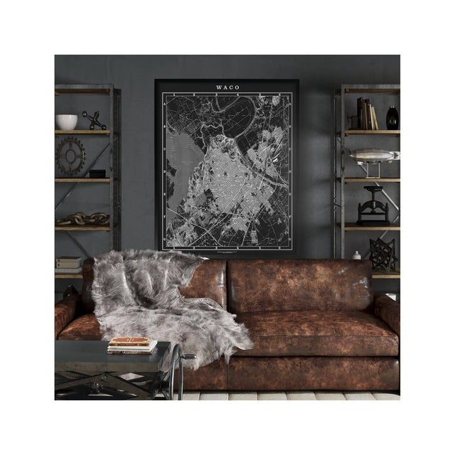
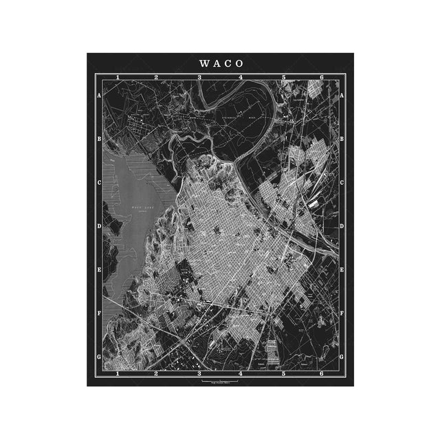
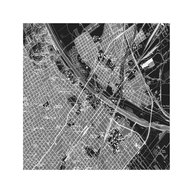
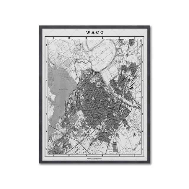
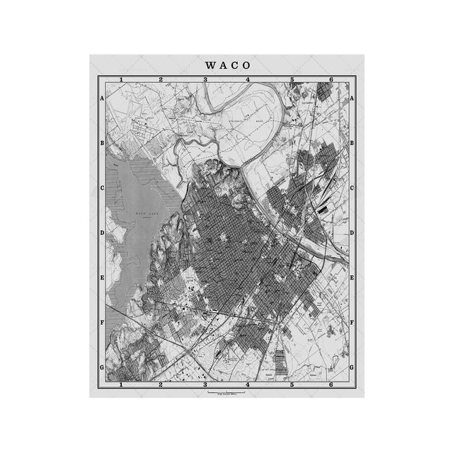
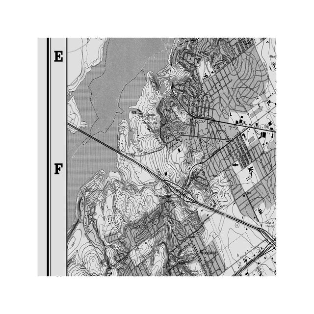
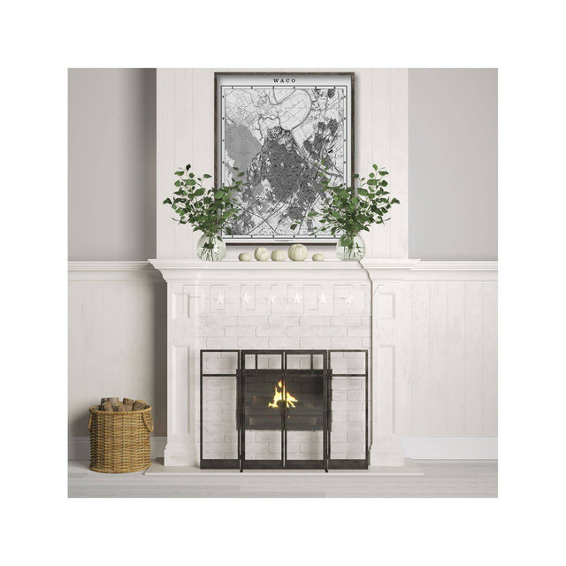
Map of Waco, Circa 1900s
About the Artwork
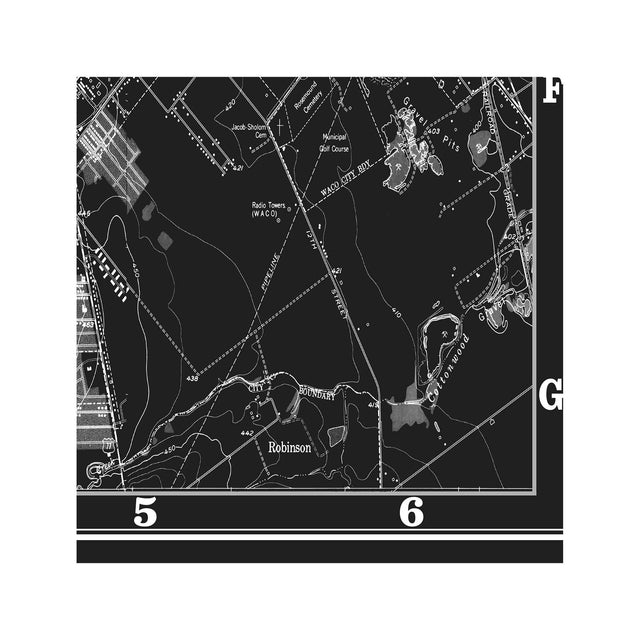
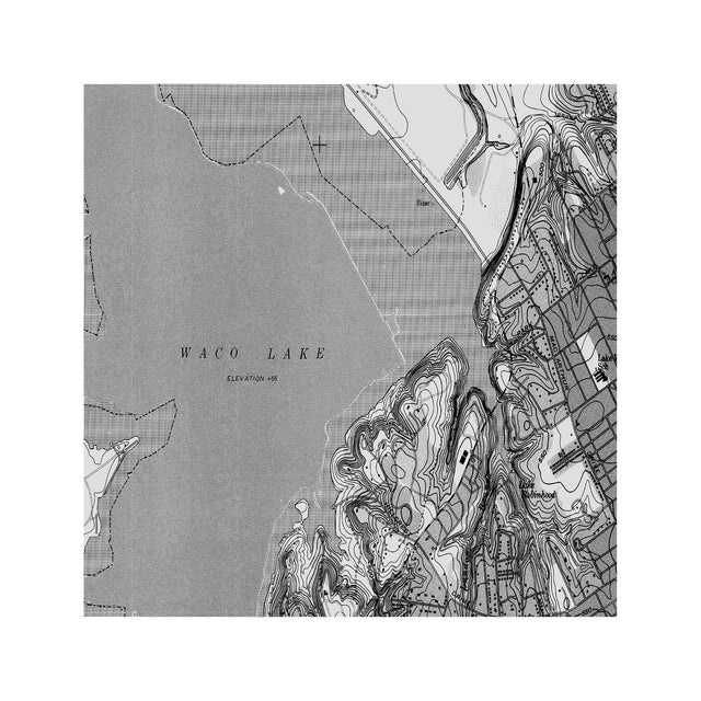
Taken from an older lithograph published in a national atlas, this map shows Waco at the forefront of Central Texas commerce. Showcasing many of Mclennan County's finest areas like Woodway, Beverly Hills, Valley Mills, Baylor University, Lake Waco, the Brazos River, Heart of Texas Fairgrounds, Bellmead and numerous surrounding areas.
This print can be customized to have any background color you prefer, simply send us a message or notify us in the notes to seller section when checking out.
• NONE of our prints come framed. Please see our FAQs for more information on the services we do offer or visit the links below to learn more about our framing recommendations:
• More info on where to frame your art: Where To Buy Frames
• More info about custom framing: Framing Suggestions
• Your artwork will ship without the watermark that is visible on the product image.
• Your artwork will ship without the 'color name' that is listed across the artwork in instances where the art is sold in an array of different colors. The color name is used to define and clarify which print color you are purchasing only.
• We do add an additional, complimentary, white border around your artwork (increases overall paper size). This border is an extension of the paper the artwork is printed on. The artwork print size itself will not change in dimensions from the size you purchase, only around the margins of your chosen artwork size will the white border be extended. We add this white border to make framing easier. The added border will tuck under the lip of the frame and it will be used to hold the artwork in place. Without it, the printed artwork itself may be covered by the lip of the frame. Therefore, we add the white border to prevent this from happening.
• We take special pride in our shipping services and our shipping materials.
• All artwork is shipped in a high quality, very durable shipping container. Your artwork is wrapped in a special elixir paper so it will be protected during delivery.
• From the time your artwork is printed, it is handled with gloves so no direct human contact will ever touch your print directly.
• Most artwork is processed in 3-5 business days (Monday - Friday) in most instances.
• For most orders, delivery is free and will ship via USPS, UPS or FedEx. International delivery carriers may differ.
• All orders placed in the USA will print and ship from our US printer.
• All orders placed in Australia and New Zealand will typically be printed and shipped from our printer in Australia. The delivery cost factors in the price difference for printing in Australia. or New Zealand compared to our USA printing costs.
• We do ship worldwide and we try to make it as efficient and seamless as possible for you to receive your order once it has been placed with us.
• We can offer a rush printing service and a rush delivery option for you. Please send us a note to inquire about both of these options as each one will incur an additional service fee and expedited shipping charge.
Currently, we do not provide returns on purchased prints as all our orders are made-to-order only.
To find out more information about our return policy, please visit: Returns
• •One of the most common questions we get is in reference to what are the differences between Giclée and Photo Rag.
We cover this information a bit more in depth so it will help you decide between the two paper options we supply: Material Differences
• For a quick and simple overview, Photo Rag is simply one of the best papers available anywhere. The Photo Rag paper absorbs inks deeper and provides richer colors overall.
• Our Giclee printed papers are a high performance sustainable ink injected onto a matte finished fine art paper. Both paper types (Giclee fine art papers and Photo Rag) have archival properties and are acid free. Photo Rag can handle bright, sun-drenched spaces better and longer than Giclee fine art papers so if the artwork will be exposed to more harsh light then Photo Rag will be a better choice.
• When offered, our canvas prints are gallery stretched and wrapped onto a wood mount with a 3/4" depth.
• When available, our rolled canvas is simply a rolled sheet of canvas with a 1" border.
• Because we are unable to ship canvas wood mounted prints over 40" in either height or width (due to the cost of freight shipping), we recommend our rolled canvas if offered on a listing as a viable option as it can be stretched and mounted by a local arts and crafts store or with a local framer near you should you choose to do so. This allows you to save money on the freight shipping cost for canvas stretched and wrapped artwork over 40" in either width or height.
• All prices listed as 'Canvas' are for gallery wrapped wood mounted canvas. If 'Rolled Canvas' is offered for a print, it will be listed as 'Rolled Canvas'.
• We also will add a 0.25", 0.5" or 1" white border to each side of fine art paper artwork unless you indicate to us differently upon checkout. This border helps make the framing of your art easier should you decide to. The white border does increase the overall paper size so a 24" x 30" print for example with a 0.5" border added to the perimter will make the final paper size 25" x 31".
• For all other questions, don't hesitate to reach out to us: Contact Us
